The Problem
Urbanization is inevitable, but random deforestation leads to catastrophic environmental damage, including air quality degradation and biodiversity loss. Traditional urban planning often lacks a quantitative, data-driven framework to decide which trees can be removed with the least ecological impact.
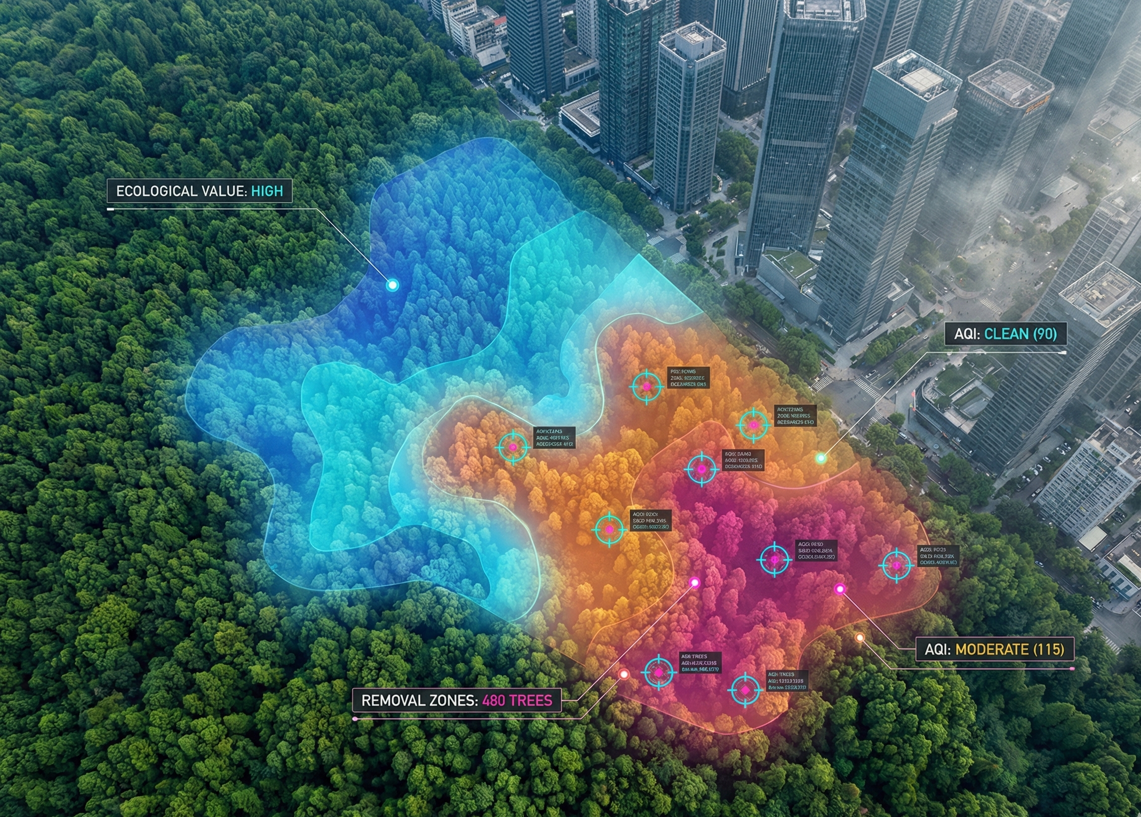
The challenge was to build a decision-support system that balances economic needs (development) with ecological preservation (air quality and connectivity).
Our Approach
We proposed a novel framework that treats forests as complex networks. Using the GeoPlant dataset (1.4 million entries) and real-time pollution data, we built a pipeline to identify "optimal" removal zones.
- Clustering (DBSCAN): We grouped scattered trees into clusters to analyze them as ecological units rather than individual points.
- Graph Theory (Tarjan's Algorithm): We modeled these clusters as a graph. Tarjan's algorithm was used to identify "Articulation Points"—critical clusters that, if removed, would break the connectivity of the ecosystem. These were strictly protected .
- Multi-Criteria Decision Making (MCDM): For the remaining clusters, we used AHP to assign weights to criteria (AQI, Species Rarity, Density) and TOPSIS to rank them. The system recommends removing only the lowest-ranked clusters.
Impact & Results
The model was validated using real-world data and showed significant improvements over random selection:
- 31.1% Improvement in AQI: Regions optimized by our model maintained significantly better air quality compared to average deforestation scenarios.
- Biodiversity Preservation: By integrating species rarity into the TOPSIS weighting, the model automatically flagged "Biodiversity Hotspots" as high-preservation zones.
- Scalability: The framework is designed to work with any spatial dataset, making it a viable tool for city planners and environmental agencies.